Over the next 24-48 hours, I expect a number of warnings and advisories to be issued. I will continue to update daily, but just so you know, I have been tracking this storm for over a week. Over the weekend I mentioned a Winter Weather Advisory had been issued and I didn’t post it before the storm because I had no confidence in the portion that included from Purgatory south. There are a lot of differences between what looks to be coming and what we have seen this year and really a lot of last season. For now, all that I can tell you is that if you have plans to do something on Friday, and you don’t like driving in the snow, or if you are new in town and not used to it, you may want to change plans around a bit. If you are used to it enjoy!
At the moment, I have 3 models agreeing on heavy snow Friday morning. They disagree on how they are going to get there, but they agree on the result. The GFS actually starts bringing in moisture Wednesday with light snow in San Juan County starting in the afternoon continuing on and off through Thursday and bringing the heavy stuff in overnight Thursday night and Friday morning. I am less confident with anything significant happening before the latter period. It is important to note that after a brief break the models are converging on another significant system coming in for the late Saturday or Sunday period. But as I say let’s take them one at a time.
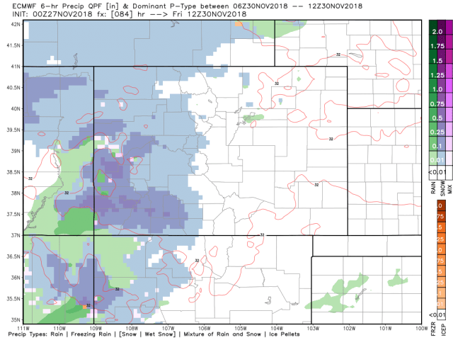
Here is what I am seeing, and have been seeing (at least on the GFS) for quite a while.
These are all Friday morning, the darker the blue the heavier the snow.
Canadian

Euro
GFS

Stay tuned.
Traveling to Albuquerque on Thursday am. Anxious to know if the snow will be bad then. Returning Saturday.
You should be fine traveling today. Stay tuned for Saturday it may depend on when you leave and how far and fast the storm tracks south