9/30/21 Thursday 7 am
Today
This is the day/night we have been waiting for. The majority of the rain predicted for this week should fall over the next 36 hours. It may take a while to get going today. The higher terrain will be the first area to see the precipitation. We will have a very active late afternoon, evening, and overnight period.
The overnight models are in good agreement that a considerable amount of rain will fall beginning later today. The models have also been consistent in saying that snow will fall down to 10,000 feet, and quite possibly lower.
Model Scorecard
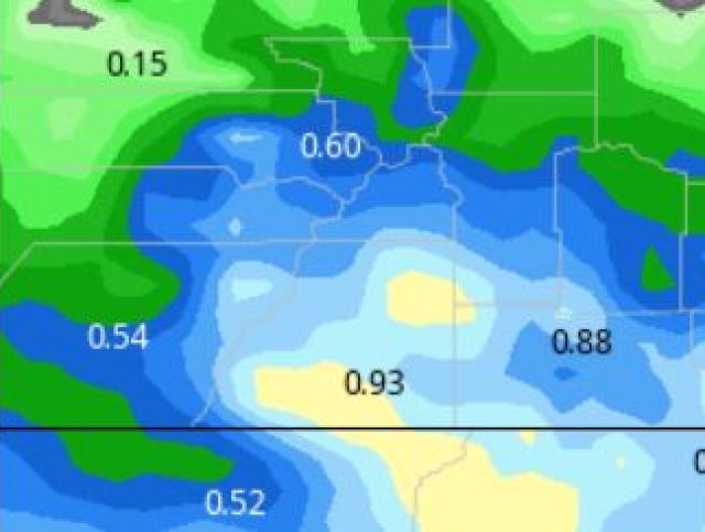
Yesterday morning’s model runs were pretty accurate. They predicted very little accumulating rainfall, with the highest amounts on the western side of the forecast are. Here they were.
GFS

Canadian

Euro

WPC

German

Of these models, the German performed the worst.
Model Forecasts
Euro
Here are the overnight model runs showing the liquid precipitation forecasts ending during the day tomorrow as the system finally departs the area.

Canadian


GFS (likely too ambitious)
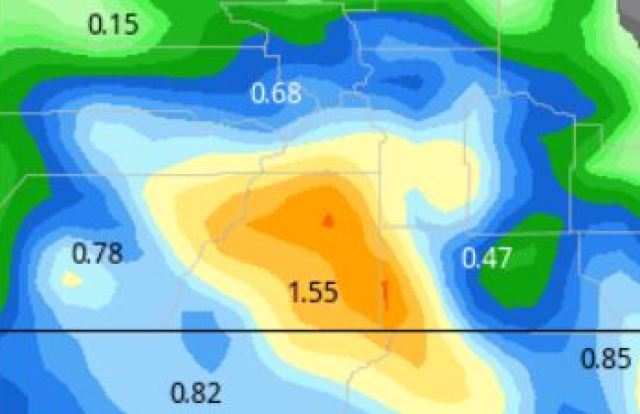
German


All of the previous runs were from overnight, they will update later this morning and I will highlight them this afternoon. The WPC run is new out this morning. However, it is likely using model data from the overnight runs.
WPC

Of these 5 models, I prefer the Euro and WPC models.
My next update will be out by 3 pm. Thanks for following and supporting the site!