10/8 Friday 1:30 pm
Models continue to be in pretty good agreement for next week’s storm. There are some developments with the weekend system, I will address them at the end of this post.
Just like yesterday we will start with the regional view and put the maps into motion. I am giving the Canadian a timeout for this run, I think it lost its way a bit for next week.
Here is the Euro

Here is the GFS which looks more bullish on the storm track.

Those changes become more evident when you look at the precipitation maps.
Euro liquid

Euro snow

GFS liquid

GFS snow

Both models show precipitation starting in the overnight hours early Tuesday morning. They also show the precipitation departing the area late on Wednesday. Temperatures will plummet Tuesday and stay cold for a few days afterward. The 60s that the lower and mid-elevation areas are experiencing today will be the warmest temps for quite a while, at least a week.
Earlier I mentioned that a few things popped up on the models’ latest runs. This is something that I have seen on prior runs. The Euro and Canadian are showing some heavier precipitation this weekend. The Euro is gunning for Wolf Creek. The Canadian is blowing up the totals for the entire forecast area. I am not ready to sign off on the Canadian. We will see what these models do on their next runs.
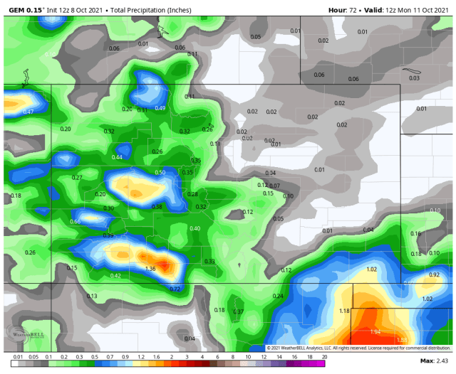
Here are the updated precipitation maps for this weekend.
Canadian
Euro

The GFS has not changed very much since its last run.
My next update will be Saturday morning, thanks for following and supporting the site!