

10:30 am
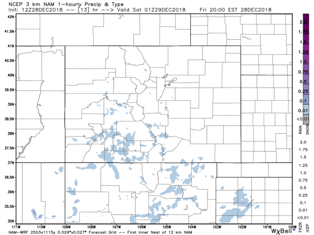
This has been fun! 7 1/2 inches here at DWest2, and I have been getting similar reports from other areas, nothing higher than 9 inches so far. Things will start to decrease in intensity as time goes on. Here is what the morning HiRes model had it shows in blue the areas getting snow at specific times. Just focus on the coverage, not the intensity.
Noon


3 pm

6 pm
We are at the point of the storm that things get complicated, I have to rely on surface maps and satellite. Here is the best guess at the surface map from WSI (WU).


If and I do mean IF this is correct. The storm has been or is in the process of strengthening slightly. I believe that has already happened and it should not be strengthening further. The way to read this is what they call a negative tilt, the angle indicates strengthening is or has occurred. If it were angled forward (positive) that indicates weakening. The purple tells us it is occluded which is just a front between a warm front and a cold front. The warm front is a technicality at best because when a cold front heads north it becomes a warm front.
Anything is possible at this point, too many scenarios to go over. I have high hopes and low expectations for Purgatory at this point. The live cam looks encouraging. They have been having internet problems up there with an outage from Century link, so not all of their cams have been online. If this thing lifts immediately north and retrogrades a bit more it would strengthen and all bets are off. As I said too many scenarios to contemplate.
Keep the reports coming let me know if you notice any erratic changes in the wind direction. I don’t expect the Euro to provide any enlightenment, I am highly skeptical of any HiRes run except for the morning (5 am run). However, I will look at the next one around 1:30 and post if there is anything interesting.