

The morning high-resolution model showed convection ticking up at 8 am.


Here is what the radar was supposed to look like.
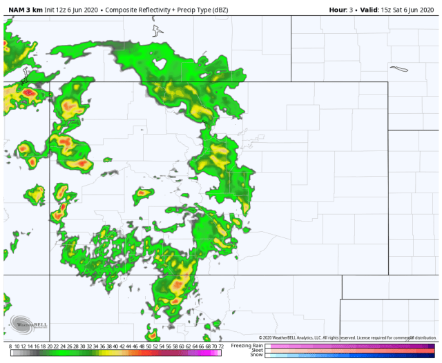
Here is the actual.


Convection is indeed boiling up. Except if you look at the donut west of Durango, that is my house, no rain, classic.
CAPE values are forecasted to increase until they hit their max at noon.

At which time simulated radar shows a strong thunderstorm crossing the area.

No promises, simulated radar gets tricky the longer you try to time it out. According to what I am seeing, dry air then works into the area between noon and 2 pm signaling the beginning of the end of the fun. By 4 pm most showers should end west of Archuleta County.
Thanks for following and thanks for the spotter reports. Hopefully, those of us who have not been fortunate enough to get some decent rain will see some over the next few hours.