10/4/22 Tuesday 6:30 am
Before I get into the short medium and long-term outlooks I wanted to share some information with everyone. I do not always share all of the rain totals I receive. I appreciate the reports it helps me determine where the models are most successful. I usually compare those totals to the network of weather stations around the area. The best source of all of the data is Wunderground.
There are other networks but they are not free. Wunderground is owned by IBM. IBM is using the data from the network to build its own private in-house short-term forecasting model. I monitor over 50 stations on the network. I cannot send links to all of them but here are a couple.
People have asked me for links so here you go.
Downtown Durango: Downtown Durango
Telluride Deep Creek: Telluride DC There are others in the area but sometimes they are not online, some only have the temperature.
From either of these links, you can scroll down and look at previous days/weeks/ months totals. Make sure you save the link before you click on previous totals.
You can also zoom out on the “Wundermap” and find stations closer to your location and access their data.
I don’t see any one feature that is going to be driving our weather in the short term, I also do not see a completely dry stretch of weather over the next several days. Isolated to scattered showers will be possible nearly every day, favoring areas along and north of Highway 160 all of the way to Ridgway. As always, the higher terrain will be most favored.
In the medium term, the models are trying to sniff out a backdoor cold front retrograding into the state mid to late next week. Cold fronts and moisture are what we like to see during the fall when the weather is typically boring. I had seen this feature on the GFS a couple of days ago, it is not on the current run. I now am seeing it on the Euro. My confidence is pretty low this far out.
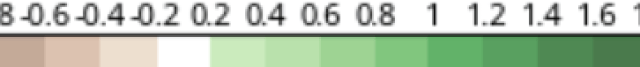
The long-term outlook looks pretty good. The Euro extended came out late yesterday and it shows average to just slightly below normal temperatures and precipitation for the next 30 to 45 days. This model usually verifies cooler and wetter than its predictions.
Precipitation anomaly through November 16th

Total snow before melting through November 16th

My next update will be on Wednesday. Thanks for following and supporting the site!
Click here to donate
Click here to submit a weather report or question
Send your weather videos to: durangoweatherguy@gmail.com
We got another 0.9″ in Mayday Monday day.