10/21/22 Friday 7 am
The NWS is holding off on issuing a Winter Storm Watch until they see a couple of more model runs today. The incoming storm will meet the criteria of a Winter Weather Advisory for areas at or above 9,000 feet. However, early-season storms can be judged with looser criteria. The thinking is that people have not driven in winter conditions for a while, so they may need an extra boost to emphasize the dangerous conditions. Don’t be surprised if a Winter Storm Watch is issued that becomes a Winter Storm Warning on Saturday (even though technically, we may not meet the criteria of a Winter Storm Warning). It’s probably a good idea with all of the new people that have moved to our area and are not familiar with driving in the winter in the mountains.
I did not notice any major changes in the overnight model runs, there is better consistency among the model in their precipitation forecasts. The winds will start to pick up today as the pressure gradient tightens due to the approaching trough. This will become more pronounced throughout the day on Saturday.
Temperatures today and tomorrow will continue to be 4 or 5 degrees above average. On Sunday the high temperature will drop to 15 to 20 degrees below average for this time of year. Monday morning the temperatures will plummet to anywhere from the single digits to around 20 degrees depending on your location.
Here are the latest model runs from overnight
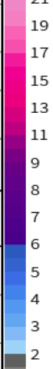
GFS liquid

You may notice in some of these maps I put a red dot on the liquid precipitation maps, that is where downtown Durango is.
The GFS and the Canadian are lower-resolution models. This means that during early-season Winter Storms when it does not get cold enough for all snow in the lower elevations the model struggles. It samples a large grid space and blends the terrain over a larger area. That is why the snow “falls off” the map in the lower elevations.
GFS snow

Canadian liquid

Canadian snow

Euro liquid


More often than not, I use a different model provider for the European liquid output parameter. This provider distinguishes downtown Durango from DRO. They also distinguish Wolf Creek from Pagosa. The European is higher resolution than the GFS and Canadian, but it still tends to overproduce the precipitation for Pagosa.
Euro snow

Here is the NBM National Model Blend. It is a much higher resolution model, equivalent to some of the short-term high-resolution models I use in the winter.
NBM Liquid

My next update will be this afternoon. Thanks for following and supporting the site!
Click here to donate for a chance to win
If you prefer to donate with Venmo: @Jeff-Givens-11
Click here to submit a weather report or question
Send your weather videos to: durangoweatherguy@gmail.com