1/30/22 Sunday 7:25 am
After my last post, the reluctant Euro and Canadian dipped their toes in the water to see how enthusiastic they wanted to get with this storm. The GFS had a couple great runs but then really backed off lower elevation totals. I expect that out of the GFS.
The models are also delaying the onset of precipitation by a couple of hours to a Tuesday evening/night start. At the moment, the best chance for advisory level snowfall looks like it will occur at Wolf Creek. Those traveling 160 east over Wolf Creek pass during the Tuesday night through Thursday morning period should start monitoring this storm.
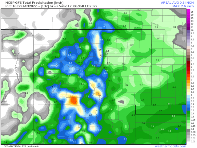
Here are the maps. This is liquid precipitation in inches, multiply by 10 in the lower elevations for snow equivalent.
Current Euro

Euro 12 hours earlier

Current Canadian

Canadian 12 hours earlier

Current GFS

GFS 12 hours earlier
Current German
![]()
German 12 hours earlier

Based on how these types of systems typically set up over our forecast area, I can find something wrong with the precipitation pattern in all of these model runs. There was one exception, but it occurred earlier than all of these model runs. It was yesterday’s morning GFS run that came out around 9 am. Assuming the storm does what similar storms have done in the past, it would look like this.

Unfortunately, storms don’t always do what they are supposed to do, they do what they want to do.
My next update will be Monday morning. Thanks for following and supporting the site!