7:30 am
Part of the daily ritual I go through is to read the area forecast discussion or AFD as it is referred to in weather circles. This is written by the various local NWS offices at least twice a day, some times more than that. I believe the original purpose of it was to inform television weather forecasters or personalities what was going on with the weather. It gets a little lost when you are in a rural secluded region as we are. I always read the AFD from Grand Junction but often times when tracking a storm I rely heavily on the NWS in Flagstaff.
You know a storm is complex when the “Long Term” portion of the AFD concludes the day the storm is supposed to arrive. As if to say “I don’t want to mess with that right now”. I don’t blame them. Yesterday I talked about trying to balance the cold air with the moisture and that would be the battleground for this storm. It will likely be Thursday before I get a better handle on rain/snow/mix levels right now it appears 7,000-8,000 with the Euro but colder with the GFS and the Canadian. However, I don’t know that I buy the other details that the GFS is trying to sell. At the end of the day, consistency is what will out, and although the models have a very basic agreement on the event, they get there in different ways.
At this point, the Euro is most believable, but I would expect it to vary throughout the week.
The Euro brings the first of a series of waves in beginning on Saturday let afternoon (I expect it will be later than that), and a series of these waves will come in through Monday. This is a wet warm inefficient snow producer (exactly the opposite of what we just experienced). I will use the default values of 10-1 to display the snow totals.
Euro snow
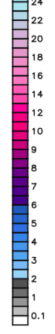

Here is the total liquid precipitation equivalent, note the discrepancies at lower elevations.
![]()

I am sure we will see changes but if this amount of moisture is coming it is great news for the high elevation snowpack for our rivers and reservoirs!
Next update Tuesday morning.
Click here to donate
Click here to contact me