Yes, we have a chance of getting some precipitation Sunday/Monday. But that is part of the smaller picture that I am excited about. I am cautiously optimistic we may handily exceed the monster 2-inch storm last weekend. The Canadian has bought in and the Euro is nudging up totals. The operational models have not had the best track record with delivering this year in the 3-5 day timeframe. So my initial thoughts are for 3-6″ inches of snow in the mountains with this gateway storm. At the risk of taking a jab at the operational models then using them to illustrate my point here is what I am talking about.
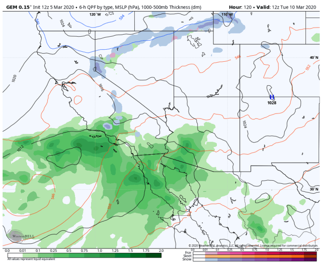
As the system departs on Monday look at what starts coming together Monday night/Tuesday morning. For those of you new the area, our most precipitous storms originate in the SW United States.

Here is the Canadian
here is the GFS

Green is good!
Here is another potentially exciting run, this is from the Euro Ensemble run which unlike the one operational model, is a blend of 50 model members showing the next 15-day total precipitation anomalies for the region. This blend is the mean (average) run with roughly half of the members with higher amounts of precipitation and half below.

Now I have a couple of good things to talk about in the coming days, and I will resume daily updates for the near future! Stay tuned, thanks for following, and thanks for reaching out with your questions and comments via email at the blue link below.
Looks like a lot of stormy weather here next weekend but Bullfrog looks to be clear and warm ? Your thoughts ? I am headed there Thursday… Thanks
Mike,
It sounds like you are talking about leaving the 12th. It is pretty early yet to see how things will pan out. My maps only go out until Sunday the 15th. Email me directly from my page the first of the week and I will see how it looks.