Tuesday Afternoon Storm Forecast

12/27/22 Tuesday 2 pm

We are about to experience the wettest 7-10 day period since the monsoon season! We will finish December with above-average monthly precipitation. 3 to 5 feet of snow will possible in the mountains between tonight and January 4th. Then another big storm will be possible arriving late Thursday or Friday (1/5 or 1/6).

Snow will start this evening in the mountains and a rain-snow mix may fall in the lower elevations before turning to snow very early Wednesday morning. Commuting could be a mess tomorrow so plan accordingly. There is a slight chance that the storm could be delayed in the lower and mid-elevations. This would not be ideal, but it is a possibility. This is a much more favorable storm track than we have seen in a while, so hopefully, that won’t happen.

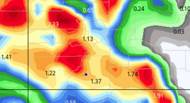
Here is my snowfall forecast for the first storm ending Thursday morning.

Wolf Creek:  16 to 25 inches

550 Passes:  14 to 18 inches

Purgatory, Telluride, Mayday:  12 to 16 inches

Silverton: 10 to 14 inches

Vallecito, Lemon area, Upper Forest Lakes, Upper Durango Hills, Tween Lakes area, Hesperus Hill, Glacier, Durango Ridge Ranch:  10 to 14 inches

Durango West I and II, Lake Durango,  Rafter J, Ouray, Edgemont, Forest Lakes, Upper Shenandoah:  8 to 12 inches

Pagosa, Deer Valley Estates, Pine River Ranches Lower Shenandoah, Trappers Crossing, Long Hollow Ranch:  6 to 10  inches

Downtown Durango area, Mancos, Bayfield:  4 to 8 inches I realize this is lower than what was outlined in the Winter Storm Warning, but the median runs from the high-resolution models are showing just under 6 inches.

All other locations below 6,500:  0 to 3 inches

Unless I see something interesting in the NWS forecast discussion this afternoon, my next update will be Wednesday morning. Thanks for following and supporting the site!

Click here to donate 

If you prefer to donate with Venmo: @Jeff-Givens-11

Click here to submit a weather report or question

Send your weather videos to:  durangoweatherguy@gmail.com

Tuesday Morning Update–The Watches Were Upgraded To Warnings

COZ021>023-272115-  
/O.UPG.KGJT.WS.A.0014.221228T0600Z-221229T1200Z/  
/O.EXB.KGJT.WS.W.0013.221228T0300Z-221229T1200Z/  
FOUR CORNERS/UPPER DOLORES RIVER-ANIMAS RIVER BASIN-  
SAN JUAN RIVER BASIN-  
INCLUDING THE CITIES OF DOVE CREEK, MANCOS, DURANGO, BAYFIELD,   
IGNACIO, AND PAGOSA SPRINGS  
159 AM MST TUE DEC 27 2022  
  
...WINTER STORM WARNING IN EFFECT FROM 8 PM THIS EVENING TO 5 AM  
MST THURSDAY ABOVE 6500 FEET...  
  
* WHAT...HEAVY SNOW POSSIBLE ABOVE 6500 FEET. TOTAL SNOW  
  ACCUMULATIONS OF 5 TO 10 INCHES POSSIBLE WITH LOCALLY HIGHER  
  AMOUNTS.  
  
* WHERE...FOUR CORNERS/UPPER DOLORES RIVER, ANIMAS RIVER BASIN   
  AND SAN JUAN RIVER BASIN.  
  
* WHEN...FROM 8 PM THIS EVENING TO 5 AM MST THURSDAY.  
  
* IMPACTS...TRAVEL COULD BE VERY DIFFICULT. THE HAZARDOUS   
  CONDITIONS COULD IMPACT THE MORNING OR EVENING COMMUTE.

Make sure you read my discussion regarding low-elevation snow amounts.

COZ019-272115-  
/O.CON.KGJT.WS.W.0013.221228T0000Z-221229T1200Z/  
SOUTHWEST SAN JUAN MOUNTAINS-  
INCLUDING THE CITIES OF SILVERTON, RICO, AND HESPERUS  
159 AM MST TUE DEC 27 2022  
  
...WINTER STORM WARNING REMAINS IN EFFECT FROM 5 PM THIS  
AFTERNOON TO 5 AM MST THURSDAY...  
  
* WHAT...HEAVY SNOW EXPECTED. TOTAL SNOW ACCUMULATIONS OF 10 TO   
  20 INCHES WITH LOCALLY HIGHER AMOUNTS OF UP TO 2 FEET. WINDS   
  GUSTING AS HIGH AS 35 MPH.  
  
* WHERE...SOUTHWEST SAN JUAN MOUNTAINS.  
  
* WHEN...FROM 5 PM THIS AFTERNOON TO 5 AM MST THURSDAY.  
  
* IMPACTS...TRAVEL COULD BE VERY DIFFICULT. PATCHY BLOWING SNOW   
  COULD SIGNIFICANTLY REDUCE VISIBILITY.


COZ012-018-272115-  
/O.CON.KGJT.WW.Y.0029.221228T0000Z-221229T1200Z/  
WEST ELK AND SAWATCH MOUNTAINS-NORTHWEST SAN JUAN MOUNTAINS-  
INCLUDING THE CITIES OF CRESTED BUTTE, TAYLOR PARK, MARBLE,   
TELLURIDE, OURAY, AND LAKE CITY  
159 AM MST TUE DEC 27 2022  
  
...WINTER WEATHER ADVISORY REMAINS IN EFFECT FROM 5 PM THIS  
AFTERNOON TO 5 AM MST THURSDAY...  
  
* WHAT...SNOW EXPECTED. TOTAL SNOW ACCUMULATIONS OF 8 TO 16   
  INCHES WITH LOCALLY HIGHER AMOUNTS. WINDS GUSTING AS HIGH AS 35   
  MPH.  
  
* WHERE...WEST ELK AND SAWATCH MOUNTAINS AND NORTHWEST SAN JUAN   
  MOUNTAINS.  
  
* WHEN...FROM 5 PM THIS AFTERNOON TO 5 AM MST THURSDAY.  
  
* IMPACTS...TRAVEL COULD BE VERY DIFFICULT. PATCHY BLOWING SNOW   
  COULD SIGNIFICANTLY REDUCE VISIBILITY, ESPECIALLY ON RIDGE   
  TOPS.


URGENT - WINTER WEATHER MESSAGE  
NATIONAL WEATHER SERVICE PUEBLO CO  
352 AM MST TUE DEC 27 2022  
  
COZ068-271900-  
/O.CON.KPUB.WS.W.0020.221228T0000Z-221229T1200Z/  
EASTERN SAN JUAN MOUNTAINS ABOVE 10000 FEET-  
352 AM MST TUE DEC 27 2022  
  
...WINTER STORM WARNING REMAINS IN EFFECT FROM 5 PM THIS  
AFTERNOON TO 5 AM MST THURSDAY...  
  
* WHAT...HEAVY SNOW EXPECTED. TOTAL SNOW ACCUMULATIONS OF 1 TO 2  
  FEET. LOCALLY HIGHER AMOUNTS POSSIBLE ON THE PEAKS. WINDS   
  GUSTING AS HIGH AS 70 MPH.  
  
* WHERE...EASTERN SAN JUAN MOUNTAINS ABOVE 10000 FEET.  
  
* WHEN...FROM 5 PM TUESDAY TO 5 AM MST THURSDAY.  
  
* IMPACTS...TRAVEL COULD BE VERY DIFFICULT TO IMPOSSIBLE. PATCHY  
  BLOWING SNOW COULD SIGNIFICANTLY REDUCE VISIBILITY. GUSTY WINDS  
  COULD BRING DOWN TREE BRANCHES.  
  
PRECAUTIONARY/PREPAREDNESS ACTIONS...  
  
IF YOU MUST TRAVEL, KEEP AN EXTRA FLASHLIGHT, FOOD, AND WATER IN  
YOUR VEHICLE IN CASE OF AN EMERGENCY.


Despite the Warning posted for Durango, Bayfield,  Mancos, and Ignacio I am very concerned that the snow will have a difficult time accumulating at the 6,500-foot level. There will likely be a big difference between Durango and the surrounding mid-elevation areas (Edgemont, Rafter J, Durango West 1&11, Forest Lakes, etc.)

That being said, if you are all about the beneficial moisture (liquid equivalent) then this storm should make you very happy. I will address all of that in my afternoon snow forecast.

Here are the latest model runs, these show total snow for the first storm ending Thursday morning. The totals are before melting and/or compaction. That is why I encourage people to measure frequently and clear the area after each measurement.

Keep in mind the lower resolution of the GFS and Canadian distort and overstate the low-elevation snow totals, especially in warm storms like this one–more on that in a minute.

Canadian–low resolution

GFS–medium-low resolution

European–medium resolution


NBM–high resolution

Notice how the low-resolution Canadian model outputs 13.2 inches of snow in Cortez, but the high-resolution NBM model shows 1 inch of snow in Cortez. For lower elevations, higher-resolution models are usually more accurate.

My next update will be Tuesday afternoon. Thanks for following and supporting the site!

Click here to donate 

If you prefer to donate with Venmo: @Jeff-Givens-11

Click here to submit a weather report or question

Send your weather videos to:  durangoweatherguy@gmail.com

Monday Afternoon Model Update–Winter Storm Watches For The Entire Forecast Area

12/26/22 Monday 2:40 pm

Numerous Winter Storm Watches are in effect and will become Winter Storm Warnings Tuesday evening. This includes all of the mid-elevation areas and all the lower elevations at or above 6,500 feet. I will post them all after the model discussion.

Model Discussion

We still have 24 hours and 4-5 more model runs coming before the first precipitation begins to fall. The models have been very consistent run to run, and model to model. The European model backed off on precipitation amounts in its current run, but so far, it is the only model to do so. The other change I am seeing from all of the models is an earlier change over to snow in the lower elevations resulting in some higher snow totals. They have also increased precipitation totals in all of the additional storms that will follow between Friday and the following Thursday. For now, I am still going to concentrate on the first storm.

The slight decrease in total precipitation in the European model could be one of two things. Either it is seeing something that the other models are not yet seeing or, it is just an anomalously low run and it will correct itself before the storm arrives.  Either solution is equally plausible. It is apparent to me that European is not properly handling the orographics that come with our diverse terrain.

Here are the latest model runs for liquid precipitation and snow. If you missed this morning’s update I explained that the snow model runs are based on a 10-1 ratio which will be too low for the ski areas, so higher totals are likely than what is shown in the models. If I had to choose only one model for guidance (and I don’t) I would choose the NBM shown below.

NOAA’s high-resolution NBM model liquid in inches

NBM snow

Canadian liquid precipitation

Canadian snow

GFS liquid precipitation

GFS snow

European liquid–my current thinking is that this is an anomalously low run and will correct itself tonight.

European snow

Here is another high-resolution blended model from NOAA’s Weather Prediction Center. This model does not have a total snow output parameter but here is the liquid.

Winter Storm Watches

  
URGENT - WINTER WEATHER MESSAGE  
NATIONAL WEATHER SERVICE GRAND JUNCTION CO  
156 PM MST MON DEC 26 2022  
  
COZ019-271100-  
/O.UPG.KGJT.WS.A.0013.221228T0000Z-221229T1200Z/  
/O.NEW.KGJT.WS.W.0013.221228T0000Z-221229T1200Z/  
SOUTHWEST SAN JUAN MOUNTAINS-  
INCLUDING THE CITIES OF SILVERTON, RICO, AND HESPERUS  
156 PM MST MON DEC 26 2022  
  
...WINTER STORM WARNING IN EFFECT FROM 5 PM TUESDAY TO 5 AM MST  
THURSDAY...  
  
* WHAT...HEAVY SNOW EXPECTED. TOTAL SNOW ACCUMULATIONS OF 10 TO 20  
  INCHES WITH LOCALLY HIGHER AMOUNTS OF UP TO 2 FEET. WINDS   
  GUSTING AS HIGH AS 35 MPH.  
  
* WHERE...SOUTHWEST SAN JUAN MOUNTAINS.  
  
* WHEN...FROM 5 PM TUESDAY TO 5 AM MST THURSDAY.  
  
* IMPACTS...TRAVEL COULD BE VERY DIFFICULT. PATCHY BLOWING SNOW  
  COULD SIGNIFICANTLY REDUCE VISIBILITY.
COZ021>023-271100-  
/O.NEW.KGJT.WS.A.0014.221228T0600Z-221229T1200Z/  
FOUR CORNERS/UPPER DOLORES RIVER-ANIMAS RIVER BASIN-  
SAN JUAN RIVER BASIN-  
INCLUDING THE CITIES OF DOVE CREEK, MANCOS, DURANGO, BAYFIELD,   
IGNACIO, AND PAGOSA SPRINGS  
156 PM MST MON DEC 26 2022  
  
...WINTER STORM WATCH IN EFFECT FROM TUESDAY EVENING THROUGH LATE  
WEDNESDAY NIGHT ABOVE 6500 FEET...  
  
* WHAT...HEAVY SNOW POSSIBLE ABOVE 6500 FEET. TOTAL SNOW  
  ACCUMULATIONS OF 6 TO 12 INCHES POSSIBLE WITH LOCALLY HIGHER  
  AMOUNTS. WINDS COULD GUST AS HIGH AS 35 MPH.  
  
* WHERE...FOUR CORNERS/UPPER DOLORES RIVER.  
  
* WHEN...FROM TUESDAY EVENING THROUGH LATE WEDNESDAY NIGHT.  
  
* IMPACTS...TRAVEL COULD BE VERY DIFFICULT. THE HAZARDOUS   
  CONDITIONS COULD IMPACT THE MORNING OR EVENING COMMUTE.
/O.UPG.KGJT.WS.A.0013.221228T0000Z-221229T1200Z/  
/O.NEW.KGJT.WW.Y.0029.221228T0000Z-221229T1200Z/  
NORTHWEST SAN JUAN MOUNTAINS-  
INCLUDING THE CITIES OF TELLURIDE, OURAY, AND LAKE CITY  
156 PM MST MON DEC 26 2022  
  
...WINTER WEATHER ADVISORY IN EFFECT FROM 5 PM TUESDAY TO 5 AM  
MST THURSDAY...  
  
* WHAT...SNOW EXPECTED. TOTAL SNOW ACCUMULATIONS OF 8 TO 16 INCHES  
  WITH LOCALLY HIGHER AMOUNTS. WINDS GUSTING AS HIGH AS 40 MPH.  
  
* WHERE...NORTHWEST SAN JUAN MOUNTAINS.  
  
* WHEN...FROM 5 PM TUESDAY TO 5 AM MST THURSDAY.  
  
* IMPACTS...TRAVEL COULD BE VERY DIFFICULT. PATCHY BLOWING SNOW  
  COULD SIGNIFICANTLY REDUCE VISIBILITY.
COZ017-271100-  
/O.UPG.KGJT.WS.A.0013.221228T0000Z-221229T1200Z/  
/O.NEW.KGJT.WS.W.0013.221228T0000Z-221229T1200Z/  
UNCOMPAHGRE PLATEAU AND DALLAS DIVIDE-  
156 PM MST MON DEC 26 2022  
  
...WINTER STORM WARNING IN EFFECT FROM 5 PM TUESDAY TO 5 AM MST  
THURSDAY...  
  
* WHAT...HEAVY SNOW EXPECTED. TOTAL SNOW ACCUMULATIONS OF 10 TO 20  
  INCHES WITH LOCALLY HIGHER AMOUNTS OF UP TO 2 FEET.  
  
* WHERE...GRAND AND BATTLEMENT MESAS.  
  
* WHEN...FROM 5 PM TUESDAY TO 5 AM MST THURSDAY.  
  
* IMPACTS...TRAVEL COULD BE VERY DIFFICULT.

Wolf Creek Pass is also under a Winter Storm Watch but it has not yet been updated. I expect between 18-28 inches there by Thursday afternoon. I will narrow that down Tuesday afternoon when I post my snow forecast for Storm #1.

My next update will be on Tuesday morning. Thanks for following and supporting the site!

Click here to donate 

If you prefer to donate with Venmo: @Jeff-Givens-11

Click here to submit a weather report or question

Send your weather videos to:  durangoweatherguy@gmail.com

Winter Storm Watch–Pattern Change Will Disrupt Travel Wednesday And Thursday

12/26/22 Monday 7:40 am

Late Tuesday into Wednesday morning copious amounts of moisture will reach the forecast area.  Heavy mountain snows of 1 to 2 feet will be possible at or above 8,000 feet by Thursday night with the first storm. A series of storms will then move through the area between late Friday through Tuesday, January 3rd.

The biggest challenge will be snow levels with the first storm. Right now it looks like all snow at or just above 8,000 feet. Snow levels will drop to 6,500 feet and lower by Wednesday night and Thursday morning.

I do expect pass closures during the storm and Friday between the storms.  Automobile travel will be impacted again in the midwest, and flights will likely be affected in Durango on Wednesday night, Thursday morning, and Thursday during the day in Denver.

I have a lot of fun maps to share so let’s jump right in.

First, we will look at total liquid precipitation from late Tuesday through Thursday evening. Then I will post the snow maps. All maps are shown in inches. Keep in mind, the snow maps do not account for melting and compaction and they tend to under forecast the higher elevations and overdo the lower elevations. The snow maps are based on a 10-1 snow-to-liquid ratio.

European liquid equivalent

GFS liquid equivalent

Canadian liquid equivalent

NOAA’s high-resolution blended model NBM

European snow (10 to 1) before melting and compaction

GFS snow

Canadian snow

Yesterday I posted precipitation maps through the middle of next week. These maps only depict snow and liquid equivalent through Thursday.

A Winter Storm Watch has been issued for areas above 8,000 feet late Tuesday through late Wednesday. I would expect that this watch will be extended through Thursday morning. I also expect a Winter Weather Advisory or Winter Storm Warning for the lower elevations beginning Wednesday night.

URGENT – WINTER WEATHER MESSAGE
NATIONAL WEATHER SERVICE GRAND JUNCTION CO
306 AM MST MON DEC 26 2022

COZ009-017>019-UTZ028-262100-
/O.NEW.KGJT.WS.A.0013.221228T0000Z-221229T1200Z/
GRAND AND BATTLEMENT MESAS-UNCOMPAHGRE PLATEAU AND DALLAS DIVIDE-NORTHWEST SAN JUAN MOUNTAINS-SOUTHWEST SAN JUAN MOUNTAINS-LA SAL AND ABAJO MOUNTAINS-
INCLUDING THE CITIES OF RIDGWAY, GLADE PARK, TELLURIDE, OURAY,
LAKE CITY, SILVERTON, RICO, MAYDAY, AND MONTICELLO
306 AM MST MON DEC 26 2022

…WINTER STORM WATCH IN EFFECT FROM TUESDAY AFTERNOON THROUGH LATE WEDNESDAY NIGHT…

* WHAT…HEAVY SNOW IS POSSIBLE MAINLY ABOVE 8000 FEET. TOTAL SNOW ACCUMULATIONS OF 10 TO 18 INCHES WITH UPWARDS OF 2 FEET
POSSIBLE.

* WHERE…IN COLORADO, GRAND AND BATTLEMENT MESAS, UNCOMPAHGRE PLATEAU AND DALLAS DIVIDE, NORTHWEST SAN JUAN MOUNTAINS AND SOUTHWEST SAN JUAN MOUNTAINS. IN UTAH, LA SAL AND ABAJO MOUNTAINS.

* WHEN…FROM TUESDAY AFTERNOON THROUGH LATE WEDNESDAY NIGHT.

* IMPACTS…TRAVEL COULD BE VERY DIFFICULT. PATCHY BLOWING SNOW
COULD SIGNIFICANTLY REDUCE VISIBILITY, ESPECIALLY ON RIDGE TOPS
AND MOUNTAIN PASSES.

_________________________________________________________

As far as Wolf Creek pass goes, there is a Winter Storm Watch, and I expect 18 to 24 inches with winds up to 50 mph.


I will do another model update this afternoon. My storm forecast will be out Tuesday afternoon. Thanks for following and supporting the site!

Click here to donate 

If you prefer to donate with Venmo: @Jeff-Givens-11

Click here to submit a weather report or question

Send your weather videos to:  durangoweatherguy@gmail.com

Sunday Morning–A Happy Holiday Update

12/25/22 Sunday 7:15 am

I come bearing gifts. The gifts are multiple storms to ring in the New Year and wring out some needed moisture over the entire forecast area. Patterns don’t last forever. Our patience in dealing with this dry pattern in December so far is about to pay off. Big changes are on the way.

I have looked at every major model for the last several days. I have looked at multiple model runs. I have looked at the blended models, deterministic models, and ensembles (multi-model guidance). They all point towards this significant pattern change.

Warm air will accompany the initial shot of moisture, it is too early to talk about rain versus snow levels. I expect there to be more snow than rain even in the low elevations.

Let’s start off by putting the maps in motion beginning Tuesday afternoon. For now, I will share the Euro model because it is the most conservative with its precipitation projections.

You will see that these systems will be coming through every couple of days. This model only projects out 10 days. This is through January 4th.

Regional view

State view

As I mentioned earlier the Euro depicts the lowest precipitation totals. These maps show liquid equivalent total precipitation in inches through January 4th.

Canadian model

GFS

NOAA’s High-resolution National Blend of Models (NBM)–This particular model is showing the potential for 3 to 7 feet of snow in the mountains!

Obviously, there is going to be a lot to talk about this week. Travel will likely be disrupted on Wednesday-Thursday. That will just be the first wave. Several additional systems will hit as soon as the weekend. I am less confident about the timing beyond Thursday. Stay tuned, we wanted winter, and it’s coming!

Next update Monday morning. Thanks for following and supporting the site!

Click here to donate 

If you prefer to donate with Venmo: @Jeff-Givens-11

Click here to submit a weather report or question

Send your weather videos to:  durangoweatherguy@gmail.com

Thursday Update

12/22/22 Thursday 6:15 am

Everything is going as expected. The cold air stayed east of the Divide and north of HWY 40 in NW Colorado. The cold front is going to continue to fall apart and will die when it hits the Northern San Juans. Light snow may develop over the Northern San Juans with little to no accumulation.

Snow showers are likely to redevelop across the 550 passes on Friday, but a stray flurry or two can’t be ruled out in other locations. Bottom line is, very little to no impact on local travel this weekend.

If you have travel concerns outside of the forecast area feel free to email me (blue link below). I still anticipate some snow across the forecast area in the Wednesday-Friday time period next week. Depending on how the models develop that/those system(s), I will probably post again late this weekend. I hope everyone has a wonderful holiday weekend!

Thanks for following and supporting the site!

Click here to donate 

If you prefer to donate with Venmo: @Jeff-Givens-11

Click here to submit a weather report or question

Send your weather videos to:  durangoweatherguy@gmail.com

Wednesday Update-Advisory Issued For The North

12/21/22 Wednesday 6:15 am

A Winter Weather Advisory has been issued for Ouray, Telluride, and Red Mountain Pass. It is primarily because of high winds and blowing snow, actual accumulation of snow should be under 3 inches.

COZ009-014-018-220230-  
/O.CON.KGJT.WW.Y.0028.221222T0100Z-221222T1900Z/  
GRAND AND BATTLEMENT MESAS-UPPER GUNNISON RIVER VALLEY-  
NORTHWEST SAN JUAN MOUNTAINS-  
INCLUDING THE CITIES OF GUNNISON, CIMARRON, TELLURIDE, OURAY,   
AND LAKE CITY  
320 AM MST WED DEC 21 2022  
  
...WINTER WEATHER ADVISORY REMAINS IN EFFECT FROM 6 PM THIS  
EVENING TO NOON MST THURSDAY...  
  
* WHAT...SNOW EXPECTED. TOTAL SNOW ACCUMULATIONS OF 2 TO 4   
  INCHES INCHES. WINDS GUSTING AS HIGH AS 70 MPH. WIND CHILLS AS   
  LOW AS 30 BELOW ZERO.  
  
* WHERE...GRAND AND BATTLEMENT MESAS, UPPER GUNNISON RIVER   
  VALLEY AND NORTHWEST SAN JUAN MOUNTAINS.  
  
* WHEN...FROM 6 PM WEDNESDAY TO NOON MST THURSDAY.  
  
* IMPACTS...PLAN ON SLIPPERY ROAD CONDITIONS. WIDESPREAD BLOWING   
  SNOW COULD SIGNIFICANTLY REDUCE VISIBILITY, ESPECIALLY IN OPEN   
  AREAS. VERY STRONG WINDS COULD CAUSE EXTENSIVE TREE DAMAGE.   
  THE COLD WIND CHILLS AS LOW AS 30 BELOW ZERO COULD CAUSE   
  FROSTBITE ON EXPOSED SKIN IN AS LITTLE AS 30 MINUTES.

Although the coldest Arctic outbreak in over 30 years will hit the Front Range and Eastern Colorado, little will change in our neck of the woods. On Friday, there may be a better chance for some scattered snow showers, I do not expect anything major.

After Friday, things will continue to be boring for a few days. As this Arctic airmass retreats north and moves east, we will get a better look at what I hope will be the beginning of a transition to a more active storm track. This would start around the 28th-30th but may not ramp up until the first week in January. That figures. I have two eye surgeries in January and I may be limited in how well I will be able to post updates during recovery. I will make it work…

My next update will be on Thursday. Thanks for following and supporting the site!

Click here to donate 

If you prefer to donate with Venmo: @Jeff-Givens-11

Click here to submit a weather report or question

Send your weather videos to:  durangoweatherguy@gmail.com

Tuesday Update

12/20/22 Tuesday 7:40 am

There are not any significant changes in the very short term. Scattered snow showers may develop later today in the forecast area’s northern portions, mainly over the 550 passes up through Ouray. Very light accumulations may occur.

Snow showers will develop again on Thursday as the artic airmass stalls north of I-70 in NW Colorado. Eastern Colorado will experience frigid temperatures on Thursday as the arctic air spills down the eastern slope and across the midwest down to northern Texas.

Here is the temperature forecast for Thursday evening. These are actual temps not wind chill values.

The models appear to be trending towards a wider spread light snow event for Friday. My confidence is pretty low with that at the moment, but I am keeping an eye on it. I am just going to throw it out there because a number of people are going to be traveling on Friday.  I will talk more about it every day this week.

My next update will be on Wednesday. Thanks for following and supporting the site!

Click here to donate 

If you prefer to donate with Venmo: @Jeff-Givens-11

Click here to submit a weather report or question

Send your weather videos to:  durangoweatherguy@gmail.com

This Is Good Stuff–I Had To Share It!

This doesn’t happen very often, but it does happen.


333   
WWHW40 PHFO 191331  
WSWHFO  
  
URGENT - WINTER WEATHER MESSAGE  
NATIONAL WEATHER SERVICE HONOLULU HI  
331 AM HST MON DEC 19 2022  
  
...WINTER STORM WARNING IN EFFECT THROUGH 6 AM HST TUESDAY..  
  
HIZ028-200245-  
/O.CON.PHFO.WS.W.0002.000000T0000Z-221220T1600Z/  
BIG ISLAND SUMMITS-  
331 AM HST MON DEC 19 2022  
  
...WINTER STORM WARNING REMAINS IN EFFECT UNTIL 6 AM HST  
TUESDAY...  
  
* WHAT...HEAVY SNOW AND BLOWING SNOW. BLIZZARD-LIKE CONDITIONS   
  POSSIBLE. ADDITIONAL SNOW ACCUMULATIONS OF UP TO 8 INCHES. WINDS  
  GUSTING AS HIGH AS 100 MPH.  
  
* WHERE...BIG ISLAND SUMMITS ABOVE 10,500 FEET ELEVATION.  
  
* WHEN...UNTIL 6 AM HST TUESDAY.  
  
* IMPACTS...TRAVEL COULD BE VERY DIFFICULT TO IMPOSSIBLE.   
  BLOWING SNOW WILL SIGNIFICANTLY REDUCE VISIBILITY AT TIMES,   
  WITH PERIODS OF ZERO VISIBILITY.  
  
PRECAUTIONARY/PREPAREDNESS ACTIONS...  
  
A WINTER STORM WARNING MEANS SIGNIFICANT AMOUNTS OF SNOW, SLEET,  
AND ICE ARE EXPECTED OR OCCURRING. STRONG WINDS ARE ALSO  
POSSIBLE. THIS WILL MAKE TRAVEL VERY HAZARDOUS OR IMPOSSIBLE. ANY  
TRAVEL PLANS TO THE SUMMITS SHOULD BE POSTPONED UNTIL THE THREAT  
DIMINISHES.  

Thanks for following and supporting the site!

Click here to donate 

If you prefer to donate with Venmo: @Jeff-Givens-11

Click here to submit a weather report or question

Send your weather videos to:  durangoweatherguy@gmail.com

Monday Update–Very Cold In The Central US Mid To Late Week

12/19/22 Monday 6 am

If you have plans to drive to the midwest this week you will really want to pay attention to the weather. We have been cold here in SW Colorado. The good news is, it is not going to get any colder here than we have already been in the coming week. In fact, the overnight lows are going to moderate slightly.

That can’t be said about eastern Colorado and the midwest. The coldest air of the year is on the way. The bad news is, still no precipitation is in our forecast in the lower elevations, with just a chance of a little snow in the mountains this week.

Here are the maps put into motion beginning on Wednesday at 5 pm through Saturday 12/24 at 5 am.

Before I post that, I have zoomed in on the start of the video to explain what you are looking at.

Notice the very thick black line bisecting Wyoming from northwest to southeast diagonally across the state. That line is actually several lines packed together and it separates the very cold air to the north from the more “mild” air to the south. The blue is snow, the darker the blue the heavier the snow.  The blue lines represent the depth of the airmass. Each successive line represents colder air than the previous. The tighter those lines are stacked together the windier the conditions will be. Keep all of that in mind as you watch this.

How cold? Here are the forecast highs for Thursday afternoon.

Here are the overnight lows for Friday morning.

After Thursday, temperatures will begin to moderate, but reinforcing shots of cold air will linger in Iowa and Minnesota through Christmas weekend.

It is still too early to look very far ahead. I hope that after this arctic airmass moves east, the models will be able to articulate a more reliable long-term forecast. Here is a snapshot of  North America on December 27.

Look at all of these low-pressure systems in the Northern Pacific (I circled in blue) that could become potential storms for us in a more favorable zonal flow. No promises for now but I am watching.

I am going to be tracking this cold outbreak all week. Feel free to hit me up with travel questions. Click the blue link to reach me. I do not check Facebook and I don’t check my special email for videos very often. But I get instant notifications if you use the link in blue.

I will be posting at least once a day until Friday this week.

Thanks for following and supporting the site!

Click here to donate 

If you prefer to donate with Venmo: @Jeff-Givens-11

Click here to submit a weather report or question

Send your weather videos to:  durangoweatherguy@gmail.com